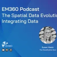
Safe Software: The Spatial Data Evolution: Integrating Data
Spatial data, also known as geospatial data, is any data that has information about a location. Upon first thought, many people directly translate this to 'maps', but spatial data is, in fact, so much more: it looks at the environment, business functions, satellite data, drones, 3D modelling, and ophthalmology. With its broad outlook, companies conventionally struggle to grasp the aspects and size of this technology. However, there is a platform on the market that works to support businesses with spatial data, namely from an integration standpoint. Say hello to the Feature Manipulation Engine, or FME for short.
Integrating data and eliminating silos is easy with FME
In this first of a 3-part podcast series with Safe Software, Susan Walsh, Founder and MD of The Classification Guru, speaks with President, Don Murray, about spatial data and integrating data. No matter what your interests are or what field you work in, whether you know it or not, spatial data is always being considered. After all, everything we see and do has a spatial component to it; where we live, how we travel - the list doesn’t end. Tune in to this episode to learn about:
- Spatial data - what it is, its variety of formats, and how it works with location-specific information
- The biggest challenges facing spatial data today
- The IT and businesses use cases and benefits of using FME to integrate spatial data
- How spatial data is stored and why traditional database management approaches will not work for spatial data
- How organisations can best position themselves to begin their spatial data integration journey
Leave the data silos in the dust! Join Safe Software on April 5 & 6 for a two day virtual event, part of the FME World Tour 2022 and discover how your data can take you and your organization further. Registration is now open - we hope to see you there! Learn more and register here.


